Barnet conservation areas

Notes on reconciling Barnet's conservation area data for planning.data.gov.uk.

Matching entities

We already have conservation areas in Barnet from Historic England's national dataset, and the GLA's London Datastore. Entities from these secondary sources need to be matched and redirected to Barnet's data, and the redline boundaries, the authorititive source.

The platform currently sets the organisation for each conservation area from the London Datastore to the individual London Borough. This should be changed to attribute them to all to the GLA so they can be recoginsed as being a secondary source.

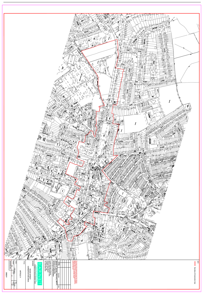
A search for conservation areas in Barnet returned 33 entities including conservation areas from neighbouring authorities which abut Barnet's local authority district boundary. This is now 16 following the changes below being implemented by the platform.

Note the references CA02 and CA09 don't appear in Barnet's data.

Monken Hadley

Entities
Entity Organisation Reference Name
44002424 48 CA01 Monken Hadley
44002424 16 1156 Monken Hadley
44008885 144 COA00000379
44009015 144 COA00000705

Wood Street

Entities
Entity Organisation Reference Name
44002423 48 CA03 Wood Street
44002423 16 7062 Wood Street
44008879 144 COA00000359

The Watling Estate

Entities
Entity Organisation Reference Name
44002420 48 CA04 The Watling Estate
44002420 16 7038 Watling Estate
44009020 144 COA00000711

Moss Hall Crescent

Entities
Entity Organisation Reference Name
44002419 48 CA05 Moss Hall Crescent
44002419 16 7242 Moss Hall Crescent

Glenhill Close

Entities
Entity Organisation Reference Name
44002418 48 CA06 Glenhill Close
44002418 16 6945 Glenhill Close

College Farm

Entities
Entity Organisation Reference Name
44002416 48 CA07 College Farm
44002416 16 7064 Finchley College Farm

Hendon, Church End

Entities
Entity Organisation Reference Name
44002415 48 CA08 Hendon, Church End
44002415 16 7251 Hendon Church End
44009018 144 COA00000713

Hampstead Village (Heath Passage)

Entities
Entity Organisation Reference Name
44002412 48 CA10 Hampstead Village (Heath Passage)
44002412 16 7063 Hampstead Village (Heath Passage)

Cricklewood Railway Terraces

Entities
Entity Organisation Reference Name
44002411 48 CA11 Cricklewood Railway Terraces
44002411 16 6944 Railway Terraces Cricklewood

Totteridge

Entities
Entity Organisation Reference Name
44002422 48 CA12 Totteridge
44002422 16 6949 Totteridge
44008888 144 COA00000392

Mill Hill

Entities
Entity Organisation Reference Name
44002421 48 CA13 Mill Hill
44002421 16 6948 Mill Hill
44009019 144 COA00000709

The PDF redline boundary includes a property on Marsh Lane which is outside of the polygon provided by Barnet.

Finchley Church End

Entities
Entity Organisation Reference Name
44006529 48 CA14 Finchley Church End
44006529 16 7240 Finchley Church End
44008887 144 COA00000391

Hampstead Garden Suburb

Entities
Entity Organisation Reference Name
44004082 48 CA15 Hampstead Garden Suburb
44004082 16 6947 Hampstead Garden Suburb
44009021 144 COA00000712

Golders Green Town Centre

Entities
Entity Organisation Reference Name
44009828 48 CA16 Golders Green Town Centre

Hendon, The Burroughs

Entities
Entity Organisation Reference Name
44002414 48 CA17 Hendon, The Burroughs
44002414 16 7250 Hendon The Burroughs
44008884 144 COA00000384

Finchley Garden Village

Entities
Entity Organisation Reference Name
44002417 48 CA18 Finchley Garden Village
44002417 16 7241 Finchley Garden Village
44009017 144 COA00000710

The Bishops Avenue

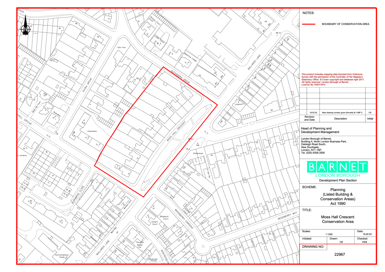
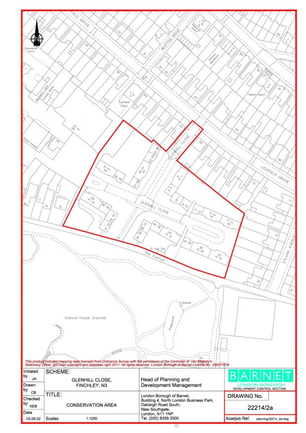
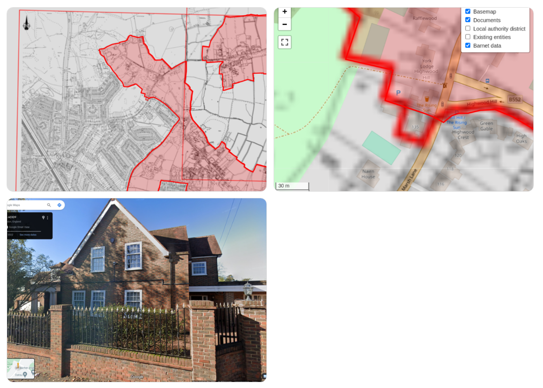
The information page includes a map and an area appraisal for The Bishops Avenue, but this seems to be a part of the Hampstead Gardens conservation area.

Source

Barnet have a policy page on their main site with a list of conservation areas which looks like the source documentation-url value: https://www.barnet.gov.uk/planning-and-building-control/conservation-and-heritage/conservation-areas.

Endpoint

Barnet also have a page documenting their open data publications and endpoints: https://open.barnet.gov.uk/dataset/20yo8/conservation-areas.

This could be added to the endpoint dataset in a new documentation-url field. We can use this to record pages like this where the data is documented separately to the information, such as on a service such as Data Mill North or ArcGIS.

There is also a GEMINI file at https://open.barnet.gov.uk/download/20yo8/ef7/ConservationAreas.xml. This is one of the metadata formats used by the data.gov.uk harvester which could be used by the platform monitor to monitor endpoints published by some LPAs. The platform could also publish a GEMINI file for each dataset.

Conservation area documents

The documentation-url against each conservation area is currently empty. 
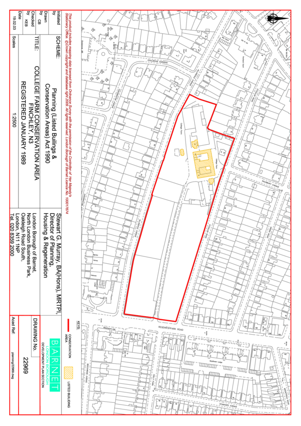
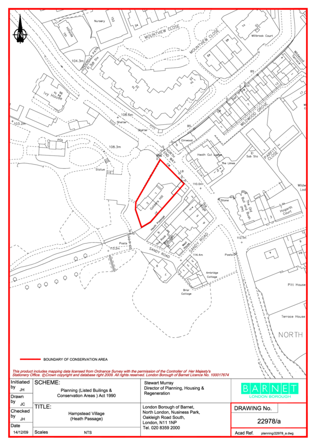
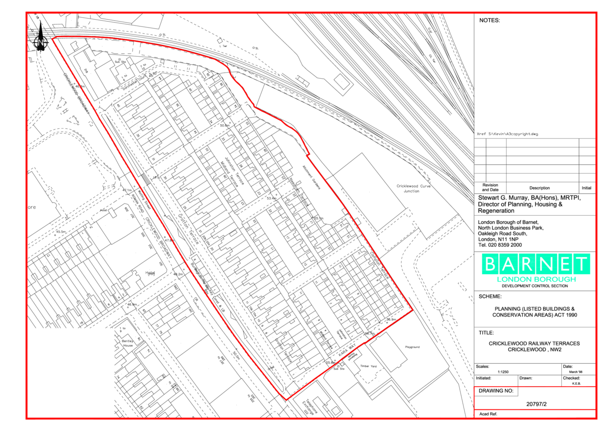
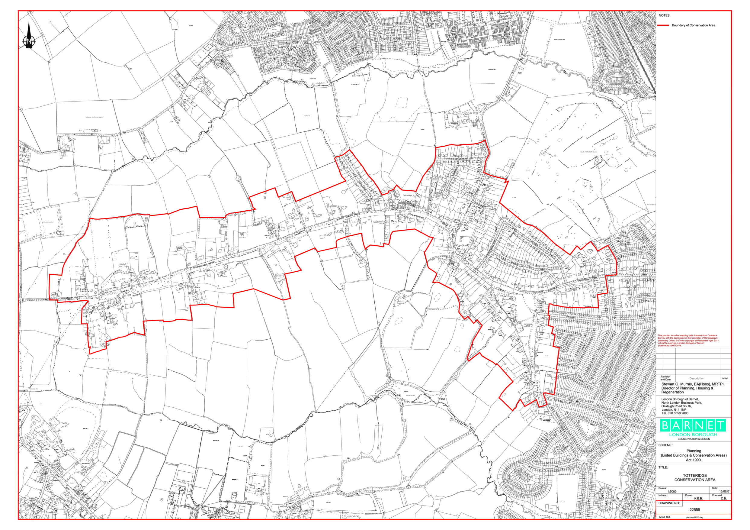
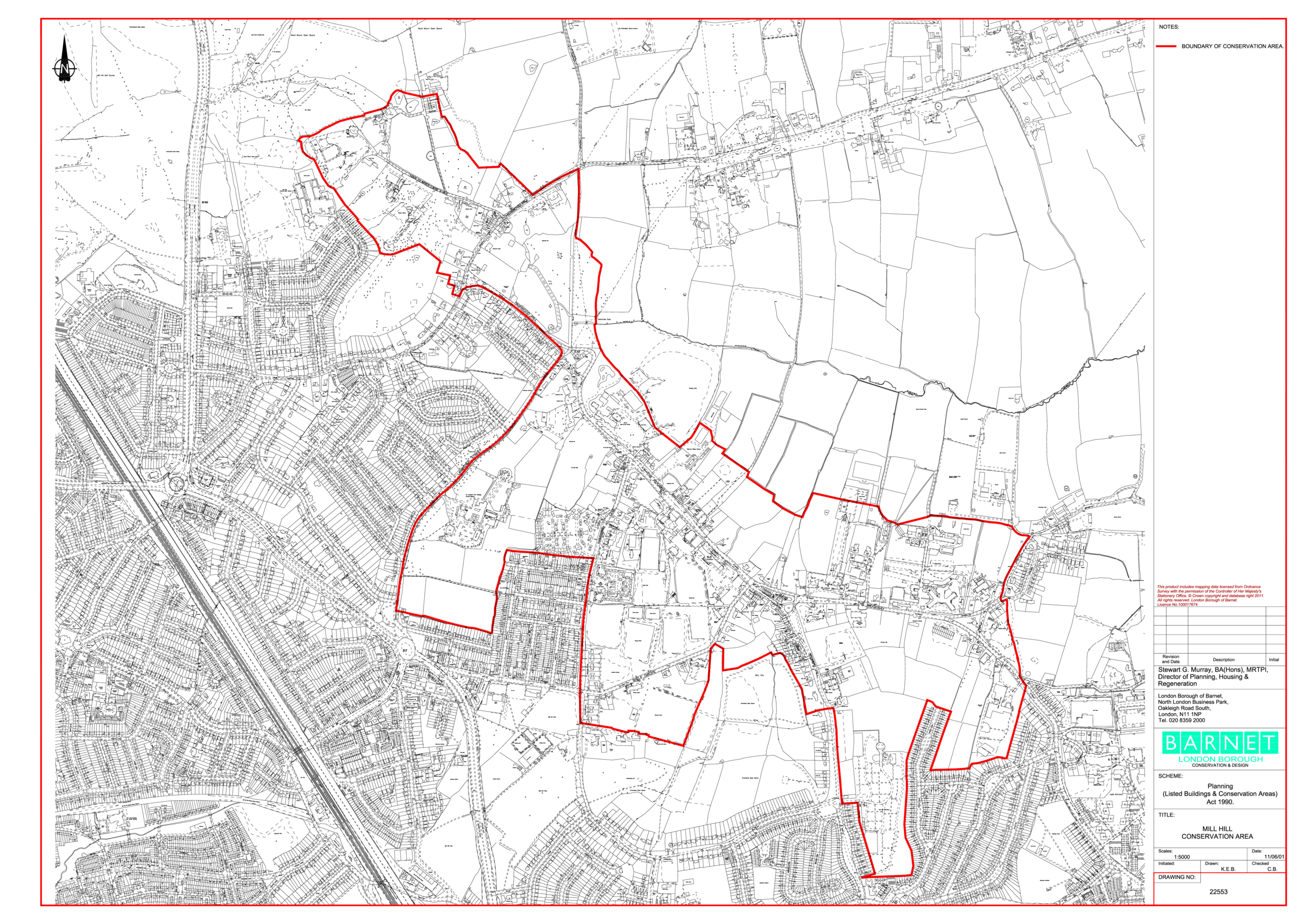
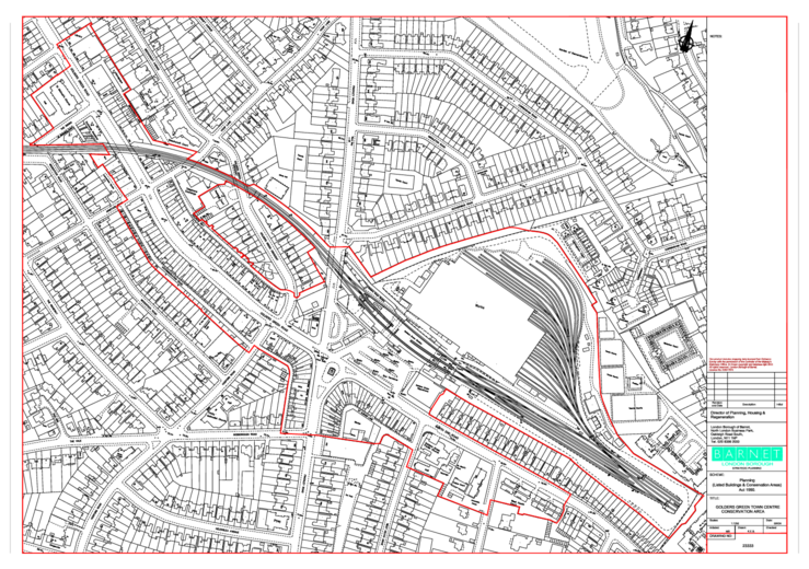
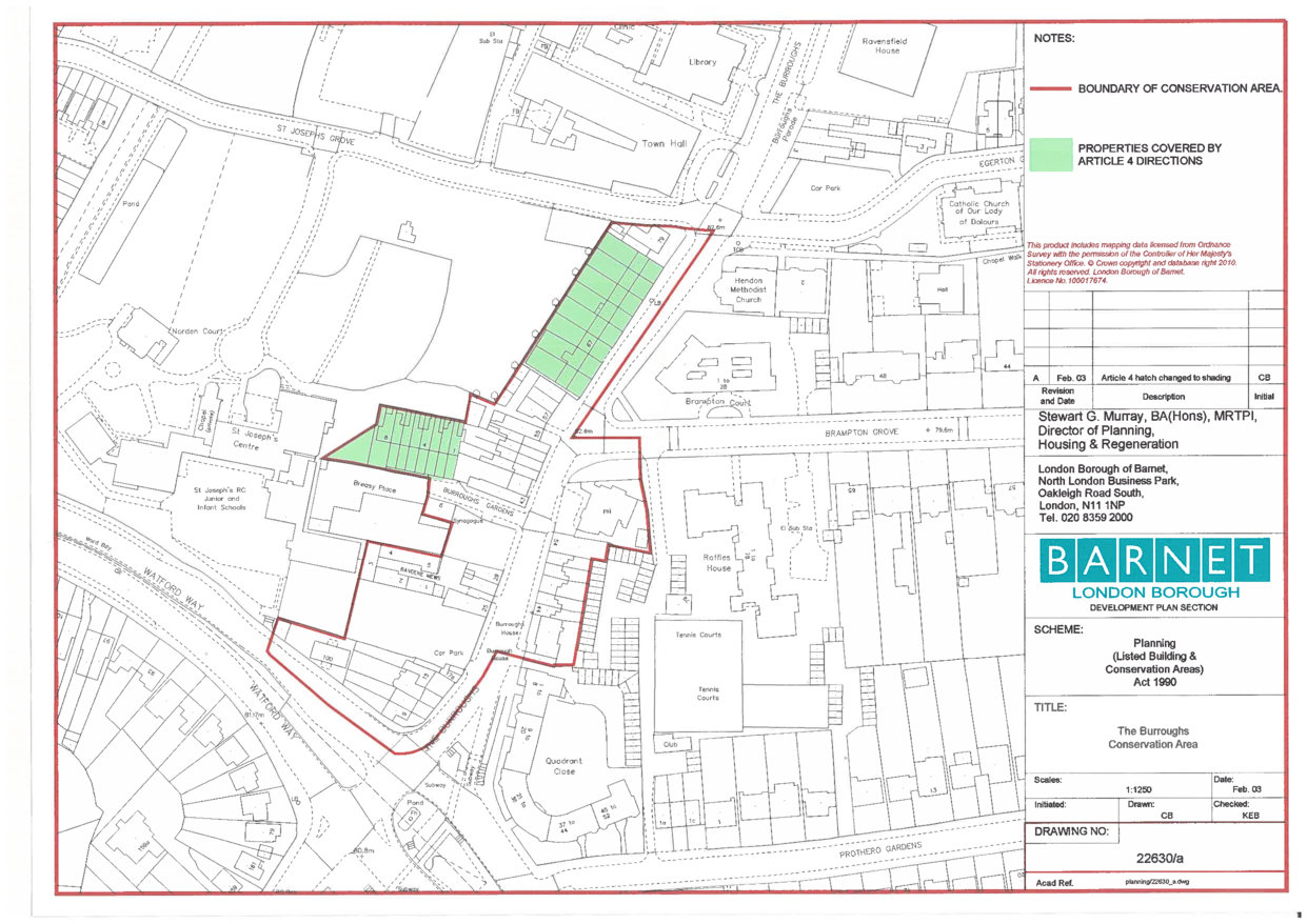
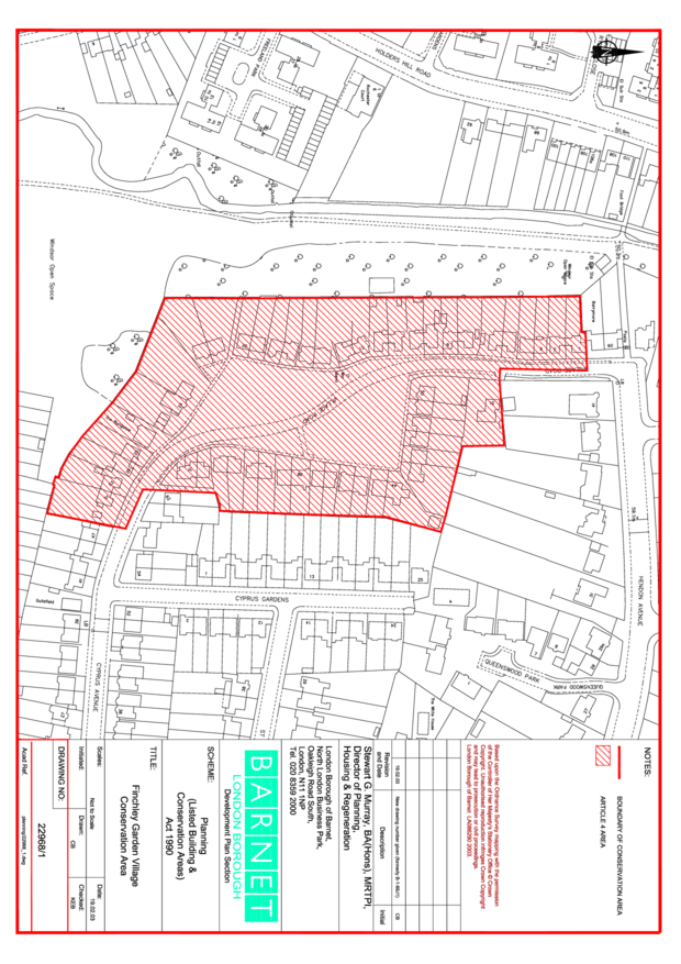
This should be set to the URL of the PDF containing the authorititive red line boundary map for each conservation area.

The area appraisal documents associated with each conservation area should be provided in a conservation-area-document dataset. We can help seed this dataset.