Digital land sprint notes
We continued work on Article 4 directions, and exploring better ways of giving feedback to people publishing data. We’ve also been collaborating on improving digital planning notices, made a prototype roadmap for our website, and had a spike for a better national map.
Article 4 directions
Article 4 directions are important for planning decisions as they define changes to permitted development rights in a designated area. We compiled a list of the directions from Buckinghamshire, Lambeth and Southwark. This initial work highlighted how we need a better way of creating a unique identifier for each direction where they don’t exist.
We also made a list with a code for each Permitted Development Right referenced in these directions, needed by the RIPA project.
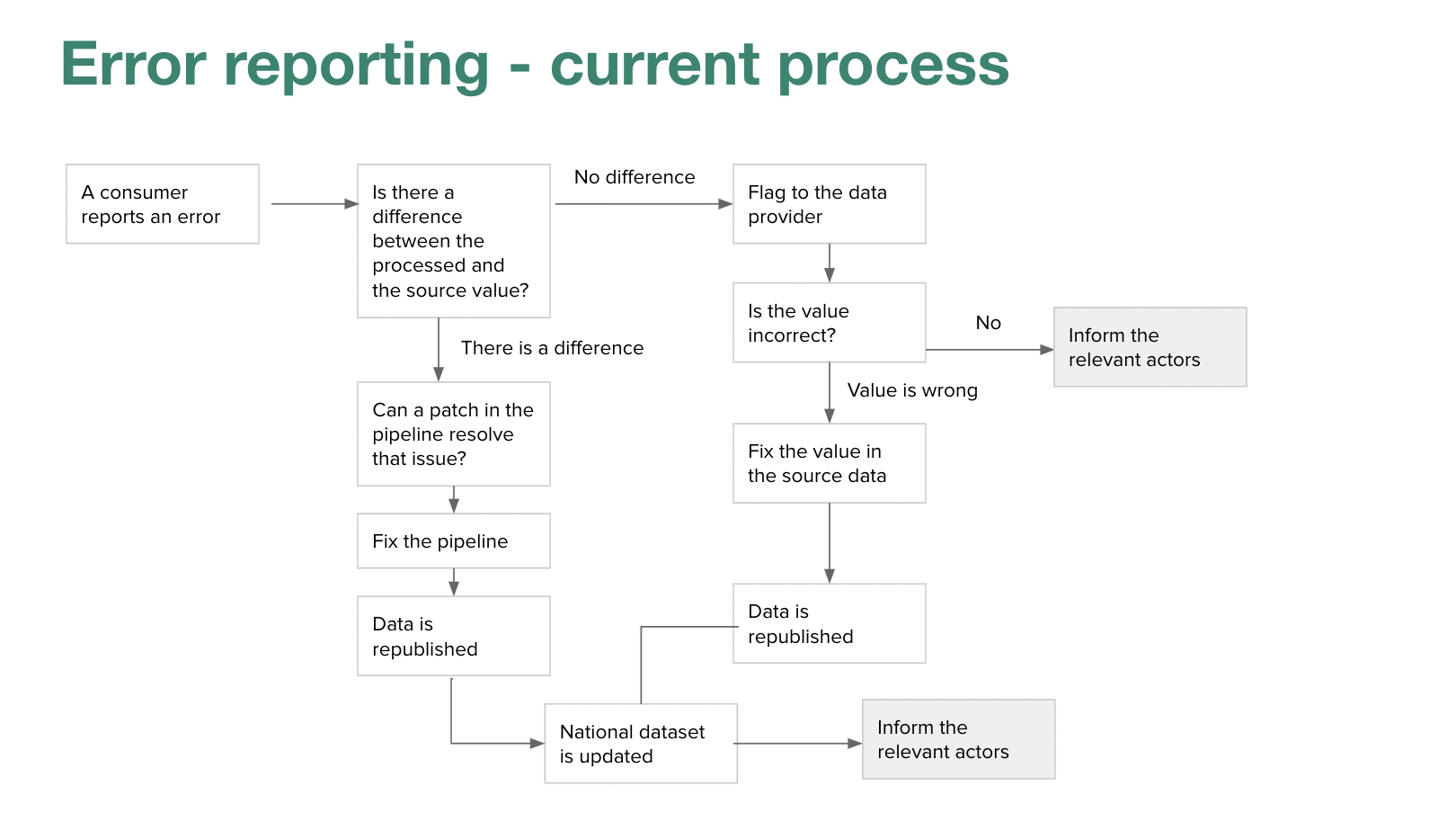
Feedback loops
Loïc and Matt continued to explore different ways of providing feedback on data published by local government. We want to present their data and highlight issues in a way which they find useful, and can easily act upon. We extended the user experience map to include what happens when someone reports an error, and identified the points in the publishing process where we think feedback has the best chance of helping to improve data.
 )
)
Policy
Euan and Rishi continued to work closely with our policy colleagues, informing discussions on the upcoming planning reform involving digital innovation, and data standards.
Systems mapping discovery
Paul helped sift supplier responses for the upcoming Planning Reform System Mapping Discovery.
Roadmap
Paul experimented with making a public roadmap for the team using the GOV.UK roadmap as a template. Very much a work in progress, we think this structure will help us with the more formal governance and planning needed for the wider planning reform programme.
PropTech
Jess and Euan have been working with Innovate UK on research and development for digital planning notices, with two projects now awarded and kicked off. We look forward to seeing how those projects progress over the next six weeks.
Jess enjoyed seeing new faces at the LandAid Tech Steering Group, and in the planning data world has been connecting with UK PropTech Association about a challenge a couple companies have surfaced in order to explore if the issue is more widespread.
She's been working to join up a variety of PropTech insights with relevant policy colleagues including EPC data analysis & house prices, work around drones & housing associations, and conversations with Modomo, TRAVTUS, WhenFresh, and Honest AI.
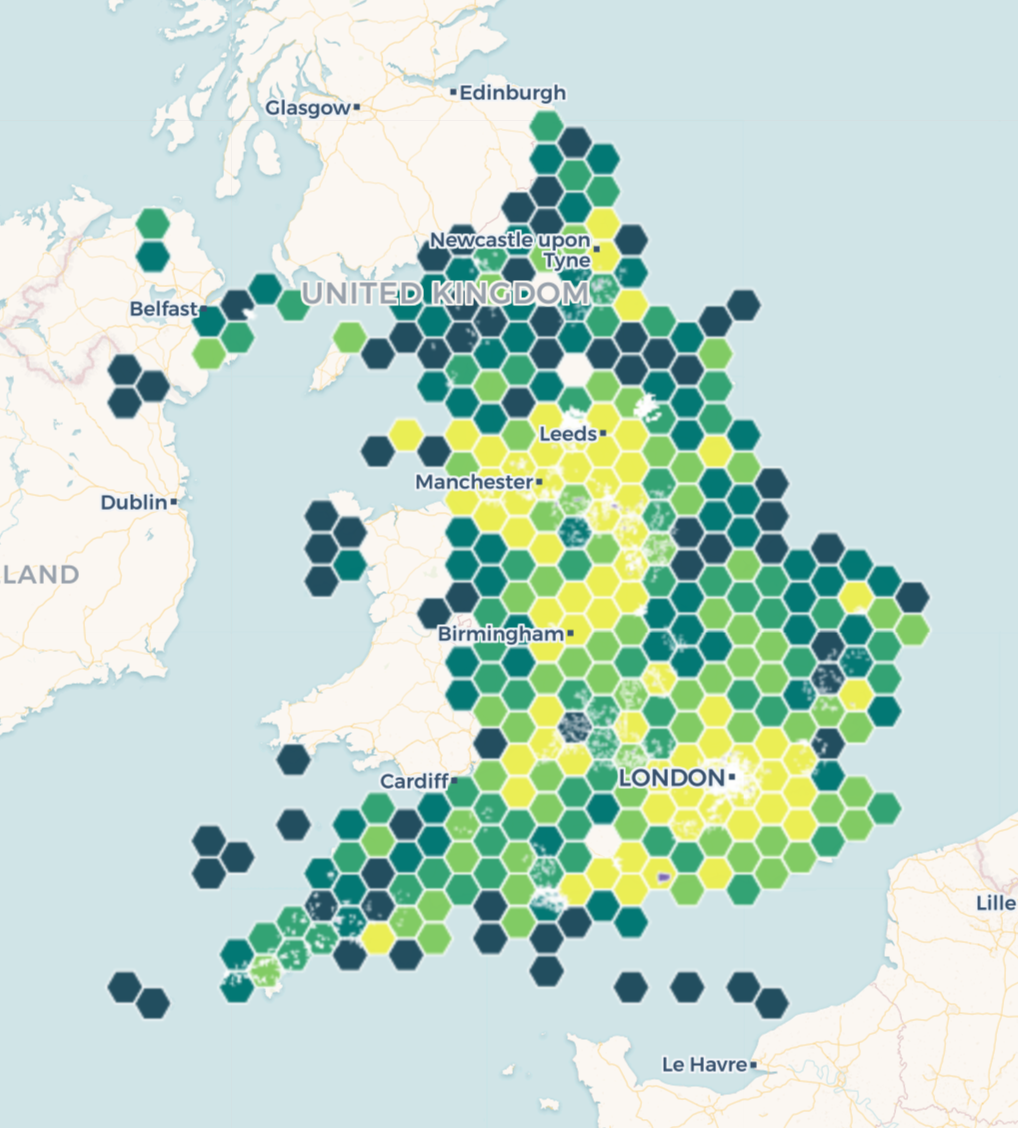
Evaluating mapping services
Kishan and Jon have begun evaluating approaches implementing our prototype national map, which has become very slow as we add more data. We imagine the mapping service also providing an API which can be used for geospatial queries.
We have a variety of options, but we’re most interested in using one of the online services. These can be used by analysts to quickly turn our data into great looking maps. For example, Jon used Carto “hexbins” to show the distribution of brownfield land across England (brighter areas have more sites). This highlights the quality of the brownfield registers, and the importance of our work on providing better feedback to publishers.
 )
)